Unraveling the Complexities of India's Political Map: A Comprehensive Guide to Understanding the Nation's Divisions and Boundaries
Blog Home
30-May-2023
Unraveling the Complexities of India's Political Map: A Comprehensive Guide to Understanding the Nation's Divisions and Boundaries
India is a country of immense diversity, with its rich cultural heritage and a long history that has shaped its present. However, the political map of India can be overwhelming and confusing, even for those who have lived in the country for years. In this comprehensive guide, we will unravel the complexities of India's political map and provide you with a clear understanding of the nation's divisions and boundaries.
Historical context of India's political divisions
India's political map has evolved over time, influenced by various historical events and struggles. Before the British colonized India, it was a collection of independent kingdoms and principalities, each with its own culture and language. The British rule in India lasted for over 200 years and had a significant impact on the country's political landscape.
After India gained independence in 1947, it was divided into two countries - India and Pakistan. India was further divided into states and union territories, with each state having its own government and elected representatives. The formation of states was based on linguistic and cultural differences, with the aim of creating states where people shared a common language and culture.
Understanding India's states and union territories
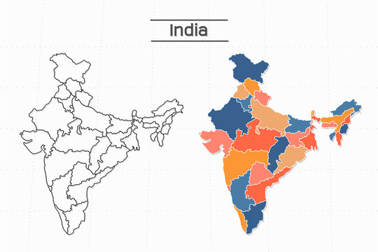
India has 28 states and 8 union territories. Each state has its own capital, government, and legislature. The states are further divided into districts, which are the administrative units responsible for implementing government policies and programs at the grassroots level.
The union territories, on the other hand, are administered directly by the central government. They do not have their own government or legislature, and their laws are made by the Parliament.
India's international borders and disputed territories
India shares its borders with Pakistan, China, Nepal, Bhutan, Bangladesh, and Myanmar. The borders have been a source of tension and conflict between India and its neighbors, with several disputes over territories.
One of the most significant disputes is over Kashmir, a region in the northern part of India that is claimed by India, Pakistan, and China. The dispute has been ongoing since the partition of India in 1947 and has resulted in several wars and conflicts between India and Pakistan.
The role of language and culture in India's political map
Language and culture have played a significant role in shaping India's political map. The formation of states was based on linguistic and cultural differences, with the aim of creating states where people shared a common language and culture.
However, language and cultural differences have also been a source of tension and conflict in some parts of the country. For example, there have been several movements for the creation of separate states based on language and cultural differences.
Major political parties and their influence on India's political landscape
India has a multi-party system, with several political parties vying for power at both the state and national level. The Indian National Congress, which was the party that led the Indian independence movement, dominated Indian politics for several decades after independence.
However, in recent years, the Bharatiya Janata Party (BJP) has emerged as a major political force, winning a landslide victory in the 2014 general elections. The BJP's rise to power has been attributed to several factors, including its focus on development and its appeal to Hindu nationalism.
Challenges to India's political unity and stability
India is a diverse country with multiple ethnic, linguistic, and cultural groups. While this diversity is one of India's strengths, it has also been a source of tension and conflict.
One of the biggest challenges to India's political unity and stability is separatist movements in some parts of the country. For example, there have been movements for the creation of separate states based on linguistic and cultural differences.
Economic implications of India's political map
India's political map has significant economic implications. The formation of states based on linguistic and cultural differences has led to the creation of diverse economic regions, each with its own strengths and weaknesses.
For example, some states are known for their agriculture, while others are known for their manufacturing or service industries. Understanding these economic regions is essential for policymakers to develop effective economic policies and programs.
Future prospects for India's political map
India's political map is constantly evolving, with new states and territories being created and existing ones being reorganized. For example, in 2019, the state of Jammu and Kashmir was bifurcated into two union territories - Jammu and Kashmir and Ladakh.
The future of India's political map is likely to be shaped by several factors, including demographic changes, economic development, and political realignments. It is essential to understand these factors to predict the future of India's political map accurately.
Conclusion: The importance of understanding India's political map
India's political map is complex and vast, reflecting the country's rich cultural diversity and history. Understanding India's political map is essential for policymakers, researchers, and anyone interested in India's geography and politics.
This comprehensive guide has provided a clear understanding of India's political divisions and boundaries, including the historical context, the role of language and culture, the major political parties, and the economic implications.
By understanding India's political map, we can appreciate the country's diversity and work towards its unity and stability.